How to Integrate Content and Language for ELLs: Map Skills, Social Studies & Science Lessons
As an ESL teacher, I’ve often seen students struggle to keep up with social studies or science because they didn’t yet have the English vocabulary or sentence structures to explain what they were learning. At first, I felt like I had to choose: either slow down the curriculum so newcomers could keep up, or keep pace and risk leaving them behind.
Disclaimer: In this blog, the terms ESL students (English as a Second Language), ELLs (English Language Learners), and ML (Multilingual Learners) are used interchangeably. While “Multilingual Learners” is becoming the more widely accepted term, “ESL students” and “English Language Learners” are still commonly used in various contexts. My aim is to be inclusive and clear to all readers, regardless of the terminology they are familiar with.

What I’ve learned is that I don’t have to choose. The most effective way to support English Language Learners is to integrate content and language objectives in every lesson. That way, students are building academic vocabulary and communication skills while mastering geography, science, and literacy standards.
Research supports this. The SIOP model (Sheltered Instruction Observation Protocol) has been shown to improve ELL outcomes by aligning content and language objectives.. Similarly, WestEd highlights that scaffolding language during core subject instruction is one of the most effective ways to close learning gaps for multilingual learners.
Why Integrating Content and Language Matters for ELLs
ELLs need more than just vocabulary lists; they need opportunities to use language in meaningful ways tied to content. As Short (2017) points out, academic vocabulary is best learned in context, not isolation. When students are taught what to learn (continents, oceans, maps) and how to express it in English (label, describe, compare), their confidence and comprehension grow together. ELL students gain access to grade-level content while developing the language to communicate their ideas.
Content and Language Objectives in Social Studies and Science
In my Maps and Globes unit, every lesson starts with two “I can” statements: one for content and one for language. For example:
- Content Objective: I can identify the seven continents and four oceans.
- Language Objective: I can label the continents and oceans using a word bank and sentence frames.
This dual approach makes expectations transparent and ensures that students are practicing English while mastering geography. Clear objectives reduce stress, guide practice, and build confidence in both subject knowledge and English use.
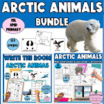
Vocabulary Development Through Map Skills and Read-Alouds
To anchor academic language, I use read-alouds from two read alouds I've created just for this unit: "Maps and Globes" and "Directions".

Each day, I choose specific pages from our read-aloud texts and decide what my language and content focus will be. At the start of the unit, I emphasize nonfiction text features. As students follow along in their mini books that mirror m read alouds, they annotate by circling features such as photos, captions, and the table of contents.

Read-alouds give students access to texts at a higher level than they might read independently. They support vocabulary development, comprehension, listening, speaking, and writing while also building background knowledge. At the beginning of the unit, I assess what students already know about maps, globes, compasses, and explorers using graphic organizers such as KWL charts or See–Think–Wonder routines.

These activities are scaffolded and differentiated so all ELLs can participate at their level but still reach the same learning goals. For example, newcomers might draw their responses on a KWL chart, beginners and intermediates use sentence starters, and more proficient students write full sentences.
I also use PWIM (Picture Word Inductive Model) to expand picture-based thematic sentences. Vocabulary is introduced in context and reinforced through reading, speaking, and writing, which helps students retain new terms while engaging with content.
While students are developing literacy skills, they are also building rich content knowledge. Through reading, writing, speaking, and hands-on tasks, they learn what maps and globes are, how to use map legends and scales, and how to read longitude and latitude. They explore different types of maps—political, physical, and resource—and discover how everyday objects and even our own bodies can be used to find directions.

Content integration also happens in science. Students take part in a hands-on investigation where they create a simple compass using everyday materials. This investigation helps them understand Earth’s magnetic field, how compasses work, and how magnets can be used to find direction. In this lesson, students magnetize a needle, construct a floating compass, and observe how the needle aligns with Earth’s magnetic north. By combining reading, vocabulary, and scientific inquiry (following the scientific method), students strengthen both their literacy skills and their understanding of core geography and science concepts.

Small-Group Lessons That Integrate Language and Content
After whole-group instruction, I pull small groups to focus on language objectives connected to the same content. A few examples include:

- Colors & Shapes on Maps/Globes: Newcomers practice naming colors and shapes to describe continents.
- Comparing Continents: Students use comparatives and superlatives (big, bigger, biggest; good, better, best) while discussing geography.
- Matching Games for Landforms & Man-Made Features: Students connect visuals with vocabulary labels to reinforce understanding.
- Neighborhood Places Vocabulary: Students trace, label, or write independently about places like school, church, police station.

Teaching Directions with Movement and TPR Strategies
When teaching the compass rose and cardinal directions, I use Total Physical Response (TPR). Students play Compass Corners or Simon Says, physically moving to north, south, east, or west. Later, we expand to intermediate directions like northwest or southeast. Movement lowers anxiety, boosts memory, and makes abstract vocabulary concrete and fun to use.

Connecting Map Skills to Students’ Communities
When maps shift to local perspectives, I integrate neighborhood vocabulary. Students label places like hospital, school, fire station, then extend by talking about community helpers. This personalizes social studies content and makes it more engaging. Students see immediate relevance, which increases motivation and helps them transfer vocabulary into everyday communication.
Exploring Types of Maps and Weather Vocabulary
Sorting physical, political, resource, and weather maps reinforces content knowledge while building language. For weather, I tie in TPR: students stretch tall for “high pressure—sunny skies” and crouch low for “low pressure—stormy weather.”

Visuals, categorizing (vocabulary word and picture sorts), and kinesthetic learning strengthen comprehension and make complex science and geography terms more accessible. Integrating language and content objectives is more than an ELL support—it’s strong teaching practice for all students.
As WestEd notes, these strategies “are not just scaffolds for ELLs—they are high-quality teaching practices for every learner”. This is beneficial for ELL because they develop academic language in context, strengthen literacy across subjects, and gain the confidence to fully participate in class discussions and tasks.
When I integrate content and language objectives, my students thrive. They master essential geography and science skills, grow stronger in English, and feel proud of their ability to contribute. If you’ve ever felt torn between teaching language or content, know this: you don’t have to choose. With thoughtful planning, you can do both—and your students will thank you for it.
Teaching Maps and Globes Across Grades: A Work-Smarter Approach for ELLs
As ESL teachers, we’re often juggling multiple grade levels and proficiency levels at the same time. That’s why I plan my units and activities with flexibility in mind. I create multiple versions of the same lesson so I can teach the same content across different groups without reinventing the wheel. Map and globe skills are taught in every grade from K–8, but the scope and depth become more complex as students move up. In my units, I differentiate by pulling the version that best matches each group: with my younger or newcomer ELLs, I focus on tracing, labeling, and identifying features, while with older or more advanced students, I introduce skills like using grids to find locations. Sometimes that even means creating a simple treasure map activity to make abstract concepts concrete and engaging. This approach allows me to work smarter—not harder—while ensuring all my students build content knowledge and language skills at the right level.
You might also like my thematic unit about apples that integrates science and literacy. REad more about it here. Check out All Apples Literacy & Science Unit


Want more first-day ESL tips, crafts, and classroom culture ideas? Sign up for my email list.


0 Comments